
Accessibility
A tactile city map on the market square is designed to help blind and visually impaired people find their way through the Hessian state capital. A second one is now in the main train station.

At the end of April 2017, a tactile city map was installed in Wiesbaden's city center, directly opposite the tourist information office on Marktplatz, another building block for inclusive participation in the Hessian state capital. The counterpart has now been located at Wiesbaden Central Station since mid-July 2017.
Using these city maps, visually impaired and blind people can find the streets of the city center as well as all important sights and (administrative) buildings, making it easier to find their way around Wiesbaden. The models on the market square and in the train station were produced by the German Institute for the Blind in Marburg.
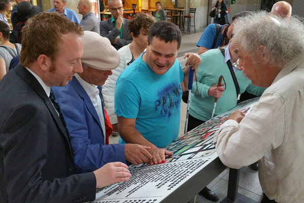
The Braille, different surfaces and large contrasts help blind and visually impaired Wiesbaden citizens and visitors to Wiesbaden to easily feel where they are and where they want to go. In addition, a legend indicates the exact location and a QR code points the way to further information on the subject of accessibility.
In addition to the tactile model of the historic pentagon and the model at the Theater-Kolonnaden, the tactile city maps on the market square and at the train station now complement the options for blind and visually impaired people to find their way around Wiesbaden.